The O'Rourke Land in Ballintur, Killowen
My aunt Theresa "Tiny" O'Rourke, went back to Killowen about 1960 to visit her relatives, presumably her aunt Elizabeth ("Lizzie"), who died in January 1962. When Tiny returned to America she said that the O'Rourke property "ran down to the Irish Sea."
Tiny's grandfather John Rourke rented, then owned, parcels 23C and 23Ec in Ballintur Townland. 23C is on the upper side of what is now Killowen Road and is shown on the first map below. Parcel 23Ec is part of a two family cottage in the lower left corner of the first map. Lizzie was living in it when she died. The other half of the cottage belonged to John's brother Edward and was passed on to his children.
A researcher in Killowen told me from memory that Lizzie's farm, when she died, was below the Killowen Road–the section designated 29 on the second map, if I am not mistaken. At some point, maybe when her brother John died, Lizzie must have changed farms.
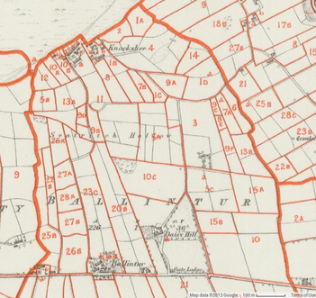
Ballintur Parcels Above Killowen Road
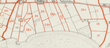
Ballintur Parcels Below Killowen Road
Those maps are from the 1840's. I found the map at http://www.askaboutireland.ie/griffith-valuation/ by choosing "Griffith's Places" and looking for Ballintur in County Down, then clicking on Map Views.
Here is a satellite view from Google Maps in 2015. You can easily match up the parcel boundaries from 1840 with the land today:
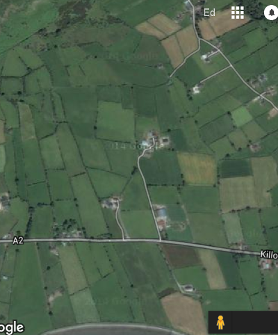
Ballintur, 2015
You can find that yourself by going to Google Maps and looking for "Blue Farm and Garden Supplies, Newry, UK." If they go out of business or in some other way disappear from Google Maps, look for Killowen Road, Rostrevor, UK.
Credits
Griffith's Valuation material (digital images and index) is Copyright © 2003 OMS Services Ltd, Eneclann Ltd and the National Library of Ireland.